I usually wake up when the sun starts to heat up the car and when the light really reaches the eyes and that is actually always 30 to 60 minutes after sunrise. I then try to hide under a shirt or a towel for another hour before I decide to start the daily activity. This morning that was enough time for about 50 cars to queue up in front of me for the gas station. I was not in a city, this hotel / restaurant / gas station was more like a big service area and there were no houses around, still people from around the area and drivers passing by managed in the early morning hours to create a queue and wait for the gas station to open at 07:30.
Not so this morning as actually the gas truck refilled the gas station’s tanks and everybody had to wait another hour before finally being attended. I knew that gas was cheap in Venezuela but I was curious to find out how cheap. It was custom for the cars with the tank on the right side to take the left lane and vice versa. After another hour more or less it was my turn and I needed 30 liters, which was ……. 3 Bolivares. A Xerox was 20 Bolivares and a bottle of water 50 Bolivares. 3 Bolivares was equal to 2 Brazilian cents and equal to half a European cent. In Brazil I would have paid R$ 100 and in Europe 45 Euros. The amount of half a cent for 30 liters is so unreal that I was asking myself why charge this ridiculous amount at all. I did not really understand democracy and capitalism and never in my life had been convinced of either system. Now I should have a month or two in Venezuela, time to learn my lessons about socialism.
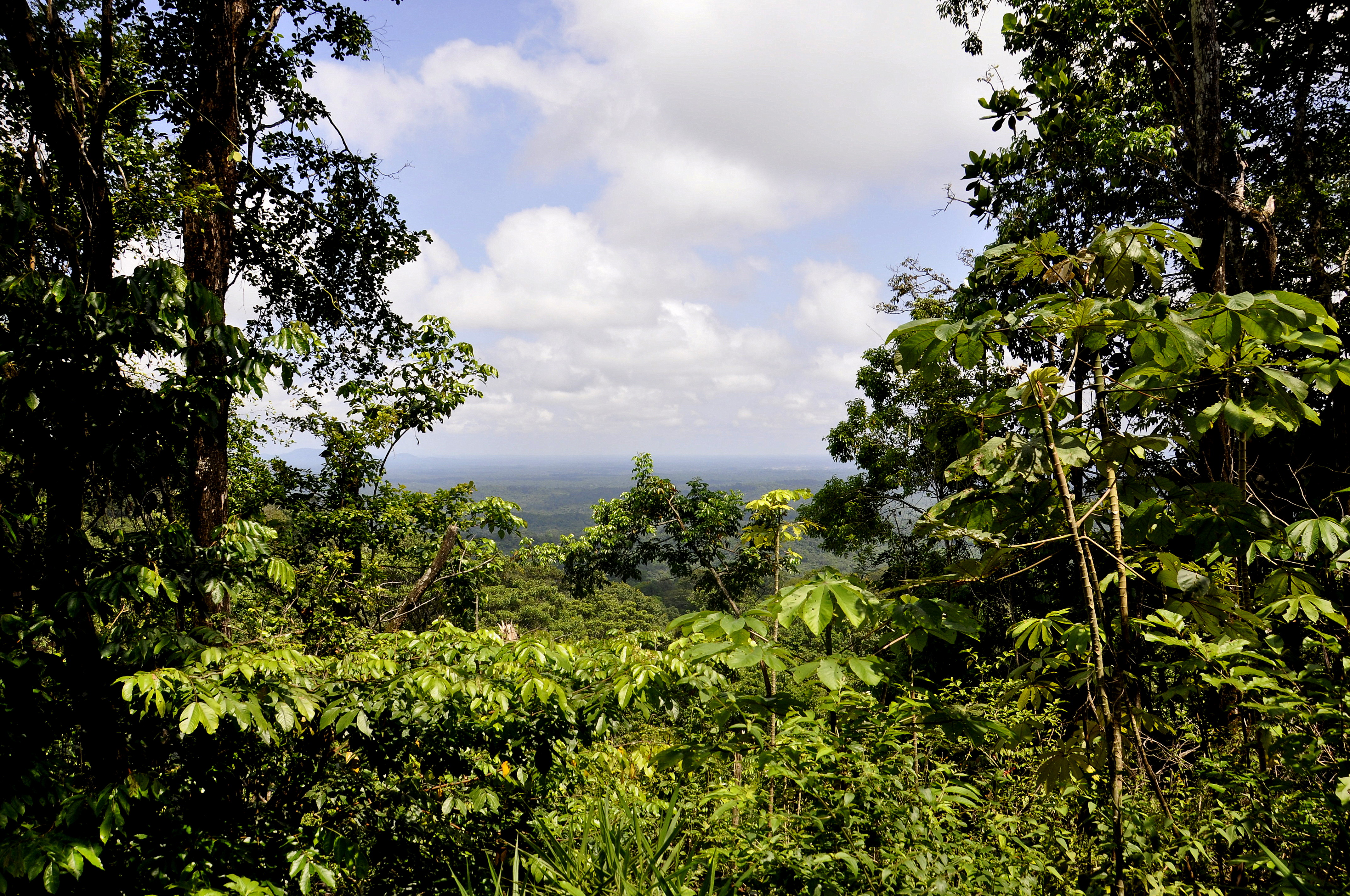
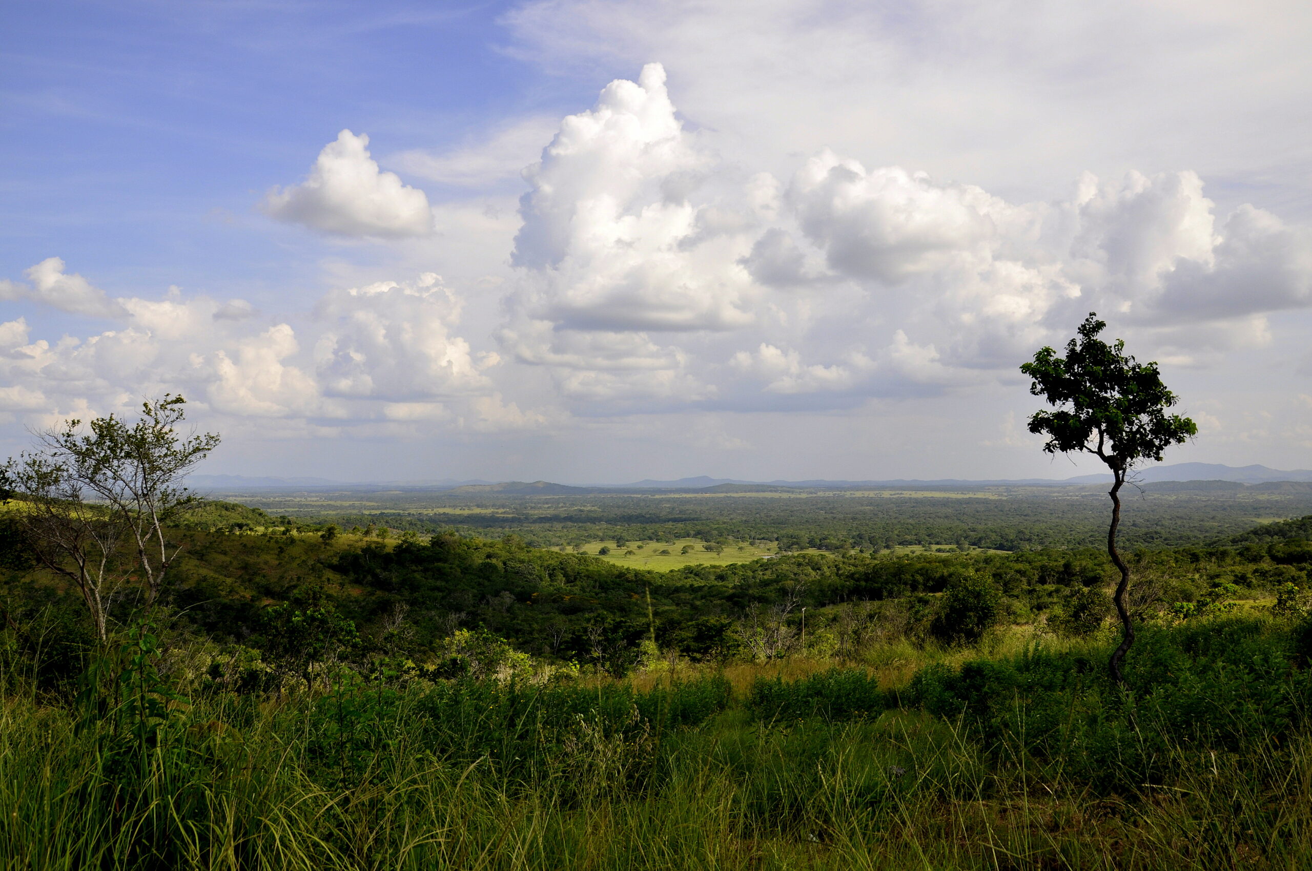
I had another day with a spectacular drive with the immediate change from the open savannah of the Gran Sabana back to the rainforest of the Amazon / Orinoco River. After a drive through the Rainforest Mountains and a sharp decline down to the valley I reached the first city and I had a break for brunch and a minute to capture this incredible chaos of traffic, trash and business. I felt like in a gold mining town of the 21st century where every minute a gun fight of two drunken gold miners / pistoleros could start.
I continued and wanted to make it to Ciudad Guayana. I entered the town pretty much at the end of the day and a ferry sign board appeared. I followed the sign board all the way to the port. I asked around for the procedure to take the ferry and had to realize that the chance was 50 / 50 for the last incoming ferry to departure. By now it was 17:00 and I could at least take a picture of the incoming ferry, but it became immediately clear that there would be definitely no departure. Anyway only eight cars had been waiting. One of the cars, actually a pick-up with five family members in the front plus two more in the back decided to take the bridge and consider the 60 km extra drive to the other side of the Orinoco River. I had a chat with the driver and decided to follow them for him to guide me to the bridge; make another 2 hours of driving into the night to make it to the final destination of Maturin.
It was getting dark and at a crossroads without signing I had my doubts about direction. A pedestrian turned up and I stopped the car to ask. The man in rather dirty clothes and a rather poor appearance confirmed the direction and told me that his car had been stolen and that he would now be walking to Maturin. For a second I was not sure but then I decided to take him with me for the final hour and for the final 80 km. Maturin had gas stations that were open in the night, the first one had only leaded gas but the second had unleaded and I filled up 40 liters for 4 Bolivares. It started to become really fun and a joy to fill up the tank. It was no fun though for me to find a secure parking for the night. I realized that there were no cars, no cars parked on the street. I left the city; still the right place seemed not to want to turn up. But then, finally.
Please click on “View Album” to see pictures in a Google+ Album.
For a small understanding of the days travel, I have included a Google Earth map. The red pins mark the locations I have stopped and taken pictures. At the bottom of the page you will find a link for all the pictures I have taken. The link will open in a Picasa album. At the top left of this Picasa album you will find the botton for a Slideshow.
Please click on map to enlarge!!!
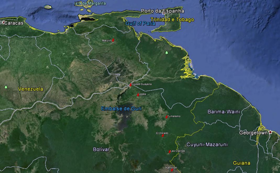
See map and distances / Siehe Karte und Entfernungen / Ver mapa e distâncias / Ver mapa y distancias
0 km Kamoiran
90 km Las Claritas
175 km El Dorado
250 km Tumeremo
370 km Upata
435 km Ciudad Guayana
675 km Maturin
Please click on “View Album” to see pictures in a Google+ Album.
Leave a Reply