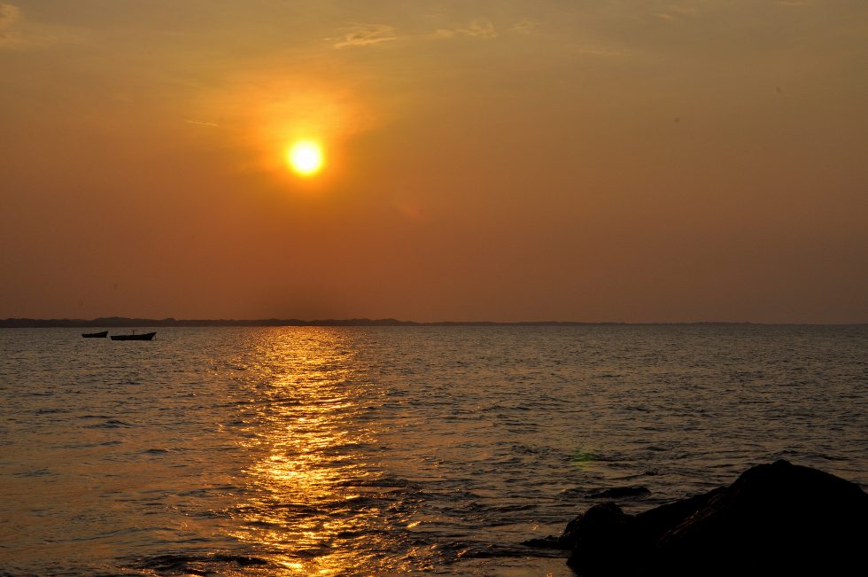
I had breakfast at my favorite bakery for the last time and said good bye to my favorite parking and drove towards the city of Coro. The motorway was a good distance from the sea and within a semi desert area, very similar to the interior of my Brazilian home state Rio Grande do Norte. For about two hours I felt I was back where I had started two month ago on august 5th. Everything seemed familiar and only my mind told me that I am driving from Tucacas to Coro in Venezuela and not from Natal to Cruzeta in Brazil.
Puerto Cumarebo 1 Puerto Cumarebo 2 Puerto Cumarebo 3
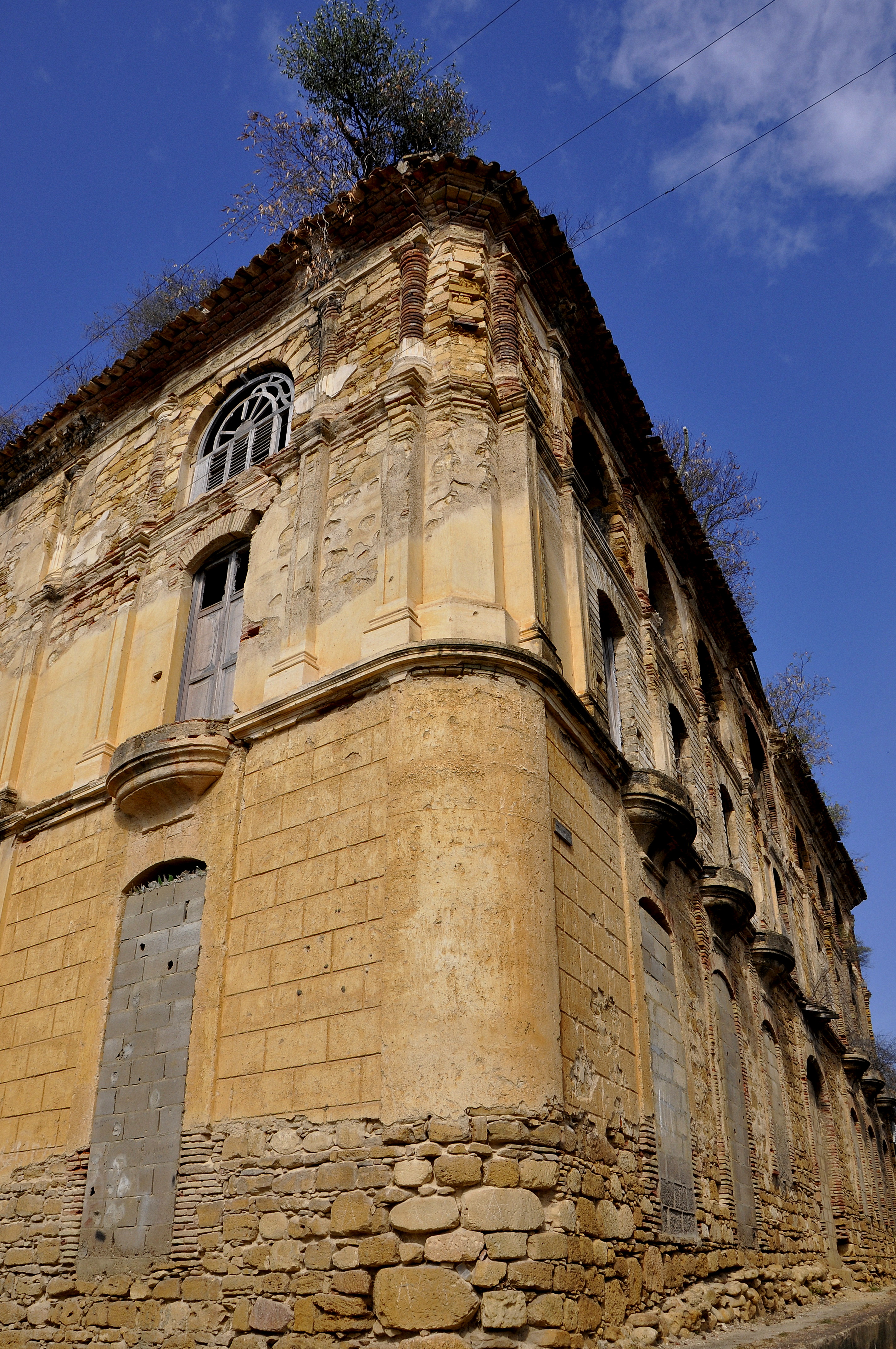
First I reached the coastal city of Puerto Cumarebo and I had a break at the historical center. The number of historical cities and villages that I had passed by now along the coastline of Venezuela made me think back in time a bit and understand the era of the Spanish conquerors who had established themselves with every journey to the new continent. I imagined the amount of ships and people that actually have travelled to the new continent in a very short time in the search for the passage to India, wealth or a position in the government. Venezuela was one of the first and probably the main country to receive most of these first ships in the early days of the colonization.
I had my snack and continued towards Coro, which actually was on the list of the UNESCO world heritage sites. Coro consists of the city itself and the port village Vela de Coro which is about ten kilometers before the city. I did not know this and was quite surprised when I entered Vela de Coro about the number of colonial facades in this rather small center. I had a good feeling about this village; everything was calm, no noisy traffic and no busy market.
I spotted a sign board for a ferry and drove towards the port which now is a military area. I learned from the conversation that the now abandoned port area once was the starting point for commercial and passenger ferries to the islands of Aruba, Bonaire and Curacao. The islands were between one hundred to one hundred and fifty kilometers away. This time I would not have to consider a decision if I would go or not as the port was no longer in service. I had three more islands on the list of Caribbean island that I would not visit during this trip. I would have to plan a completely separate project for the Caribbean and most probably a project with a sailing boat to actually visit the majority of the hundreds of islands.
Please click on “View Album” to see pictures in a Google+ Album.
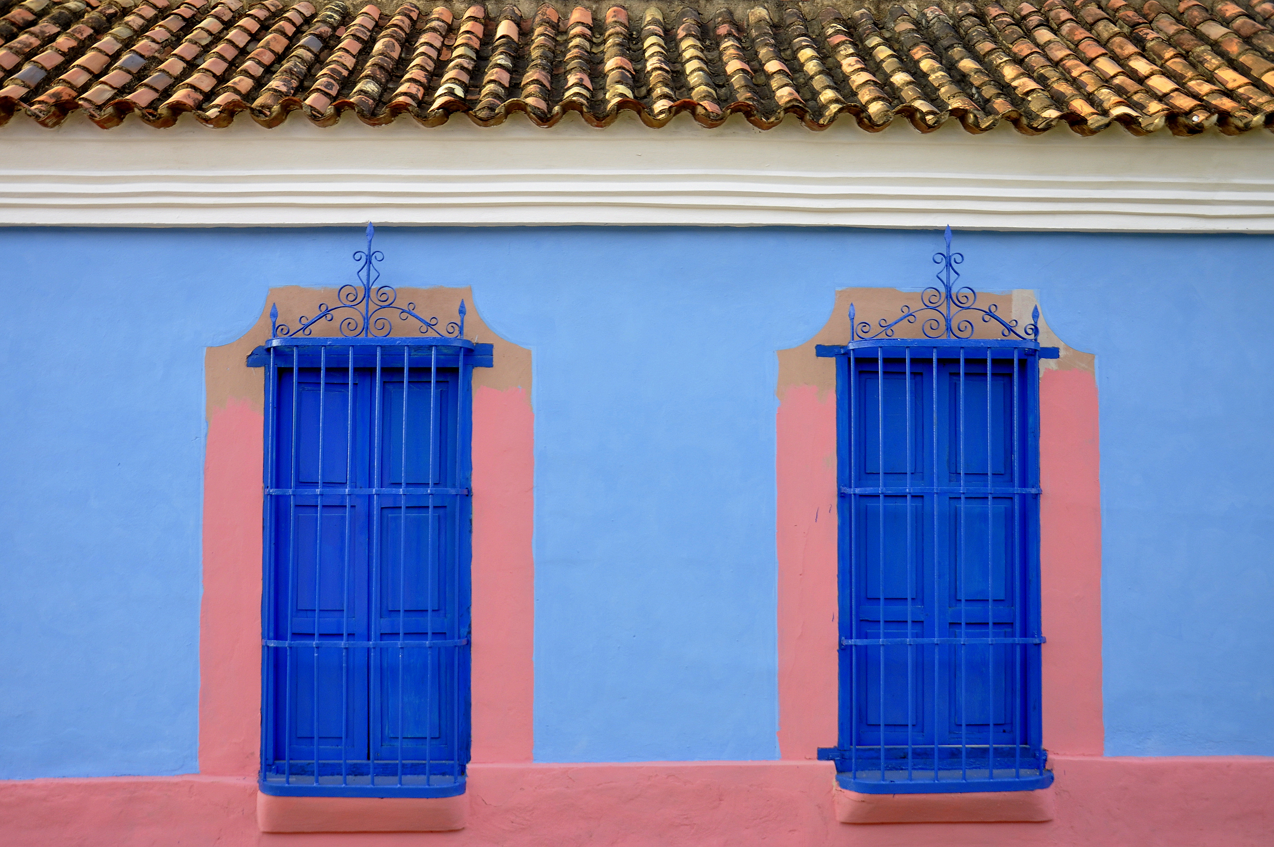
I decided to stay in the fisher village of Vela de Coro and walked twice around the center of the village to take lots of pictures of the colorful facades of the different colonial houses. Some of the houses had the door open and you could have glimpse into the Spanish patio. One of the houses had the door open as well; I looked inside and it was home to a self-made ice cream shop. I chose a vanilla cup from the menu but received a pine cup instead. The ice cream was delicious and refreshing and at my second round I stopped again and had a second ice.
I wanted to stay for the night and parked next to the four emergency cars on the public parking area at the port of the village. Mine was the only car and the staff on duty came after about one hour to wake me up and ask stupid questions. It was close to midnight and I was tired and tired of talking so I started the car and moved on to Coro and went there straight to the university hospital.
Please click on “View Album” to see pictures in a Google+ Album.
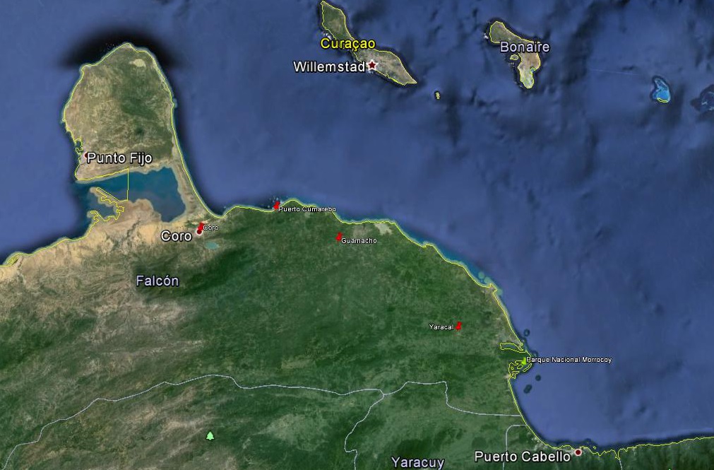
For a small understanding of the days travel, I have included a Google Earth map. The red pins mark the locations I have stopped and taken pictures. At the bottom of the page you will find a link for all the pictures I have taken. The link will open in a Google+ Album.
Please click on map to enlarge!!!
See map and distances / Siehe Karte und Entfernungen / Ver mapa e distâncias / Ver mapa y distancias
0 km Morrocoy
35 km Yaracal
110 km Guamacho
155 km Puerto Cumarebo
205 km Coro
Please click on “View Album” to see pictures in a Google+ Album.

Leave a Reply