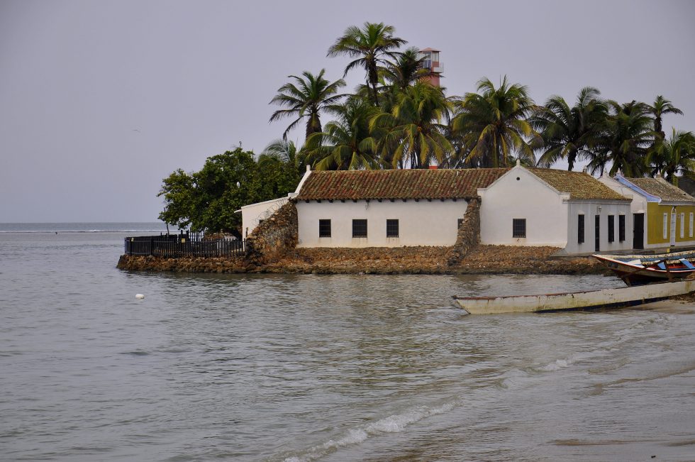
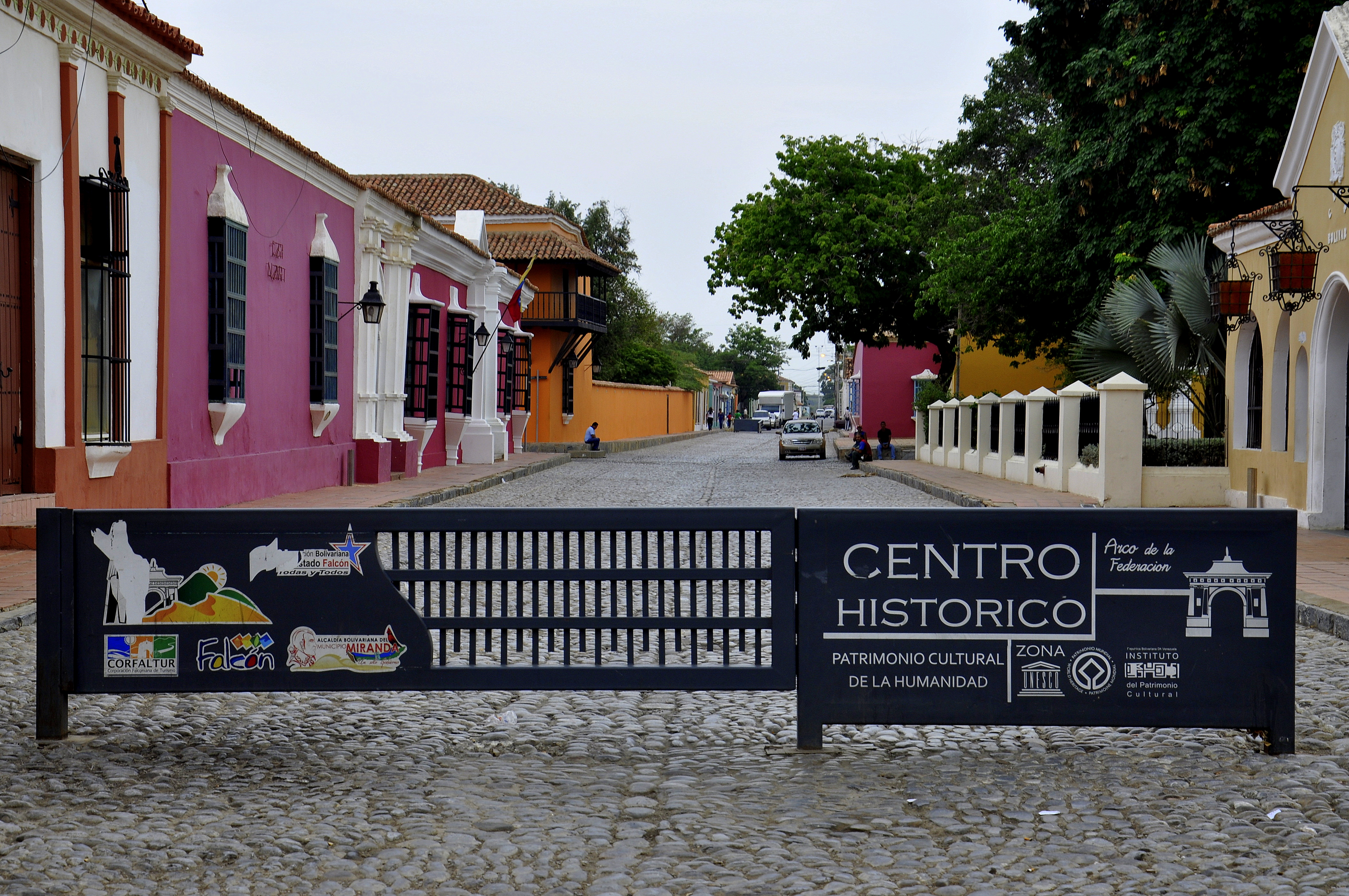
I went straight from the hospital parking to the colonial center which was a gated area and prohibited for cars. The area enclosed was more or less three street blocks plus the church and the square. The area had definitely historical character but did not really convince me to be a UNESCO world heritage site.
I walked the gated area and my impression was that the trash collection did not work anymore for the area as well as the sewage system. It was a grey day and I was a bit disappointed and decided to go to the National Park Los Medanos.
The National Park Los Medanos was just outside the city limits and the main attraction was massive dunes which made its way towards the motorway and blocked half of it. I parked the car and took a very quick walk up the dunes to have a look of the extensions and take some pictures and decided to go and explore the Paraguana peninsula and drive to the most northern point to try to catch a view of Aruba.
Please click on “View Album” to see pictures in a Google+ Album.
I drove to the city of Punto Fijo hoping to find an interesting beachfront city but again I got disappointed. The city was a petrochemical industry dependent city and had not the historical character of the other cities in the coastal area. The city was disorganized, overcrowded and grey like the sky. I was hungry and stopped at a bakery to have breakfast and then immediately rushed out of the city.
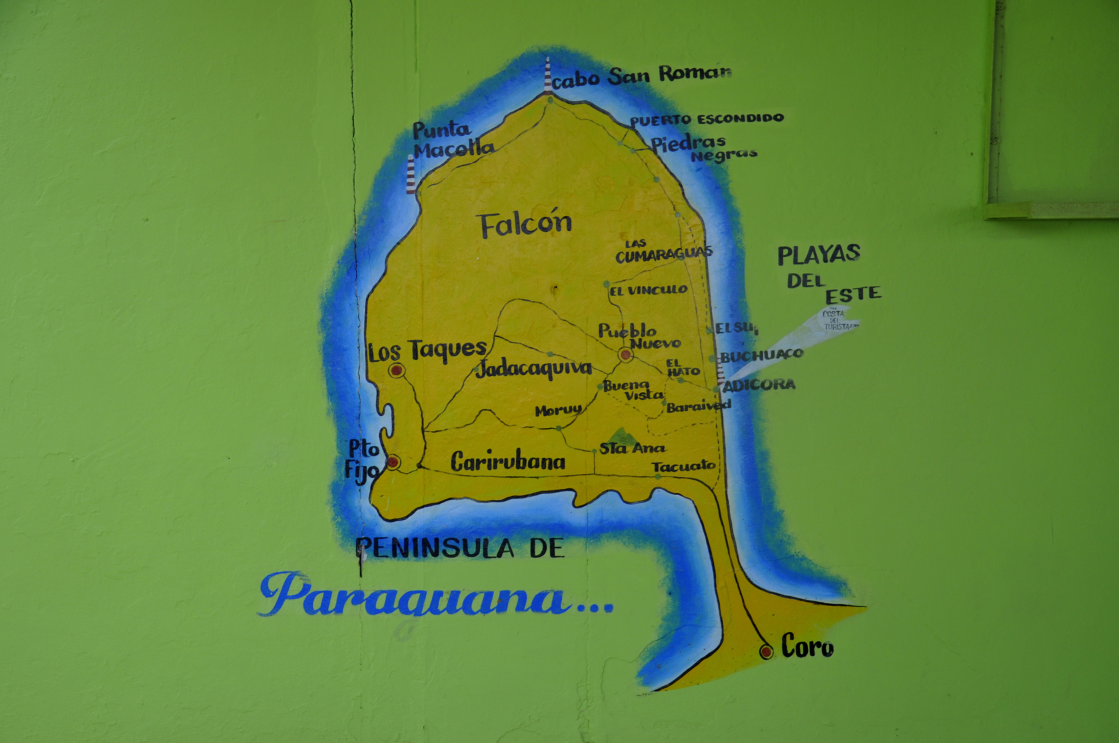
It became quickly quiet and empty. At the same time it started to rain which I liked a lot. The rain cleaned the car and maybe also the bad energy that was accompanying me today. I asked for the way several times and made it to the right road towards the most northern point Cabo San Roman. I arrived at the lighthouse and it was still raining but the sky just lighted up to give me a quick thirty kilometer view onto coastline of the island of Aruba and the high-rise of the city of San Nicolas. Just as I finished taking my pictures the sky turned dark grey and a really heavy shower poured down.
Please click on “View Album” to see pictures in a Google+ Album.
I had come to Cabo San Roman from the western side of the peninsula and wanted to go back on the eastern side which basically was not a problem as the village of Adicora was indicated and I just had to follow the road signs. I arrived in the fisher village of Adicora and it was still raining. I parked at the beach and still found some tourist hiding under the umbrella or taking a bath in the warm water. I had an ice cream and went for a walk in the rain towards the lighthouse. The village was more what I had been looking for today and what I had expected for the Paraguana peninsula in the heart of the Caribbean. I spent the afternoon in the fisher village and it stopped raining. From here it was only a short drive back to Coro where I would stay at the university hospital for another night.
Please click on “View Album” to see pictures in a Google+ Album.
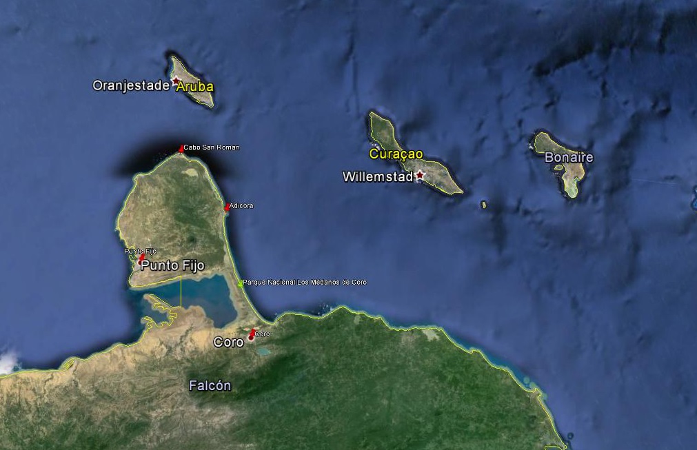
For a small understanding of the days travel, I have included a Google Earth map. The red pins mark the locations I have stopped and taken pictures. At the bottom of the page you will find a link for all the pictures I have taken. The link will open in a Google+ Album.
Please click on map to enlarge!!!
See map and distances / Siehe Karte und Entfernungen / Ver mapa e distâncias / Ver mapa y distancias
0 km Coro
75 km Punto Fijo
170 km Cabo San Roman
235 km Adicora
295 km Coro
Please click on “View Album” to see pictures in a Google+ Album.

Leave a Reply